Page-Trowbridge Radioactive/Toxic Waste Landfill and The Water SupplyBuried Poison and Poisoned Wells
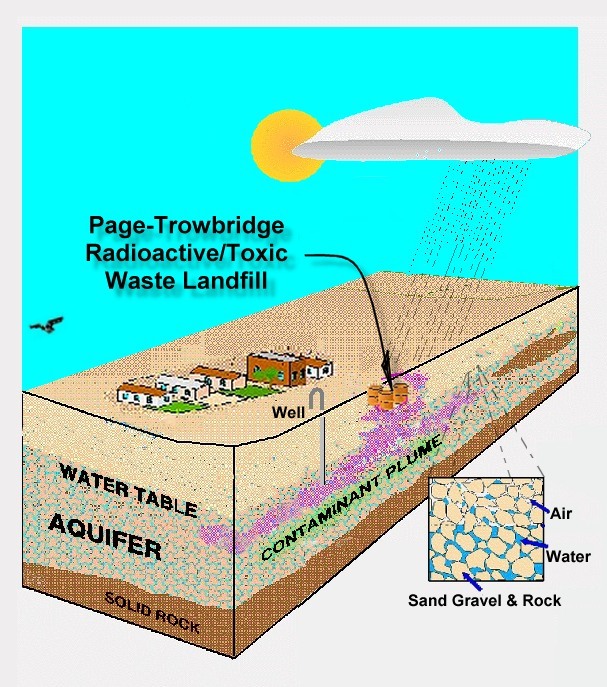
The short story is this: For well over two decades, the University of Arizona disposed of millions of pounds of radioactive and toxic waste by burying this waste at the Page-Trowbridge disposal site.
Large quantities of liquid toxic waste was poured into the unlined pits. Bottles of toxic waste were thrown into the pits then broken. Large quantities of the radioactive and toxic waste was buried in the flimsiest of containers (e.g. boxes and bags) Later the radioactive and toxic waste was packaged in 55 gallon steel drums prior to burial. However, there is evidence indicating that the acid soaked ground from years of prior dumping, eroded the steel drums allowing the deadly content to soak into the earth. If the radioactive and toxic waste reaches the water table, it will disperse in a plume of contamination through the aquifer destroying the communities that rely on the water from that aquifer. Communities At Risk
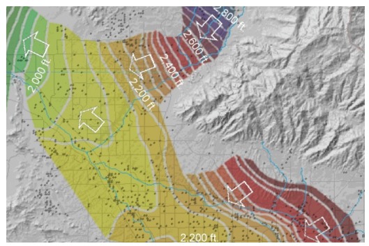
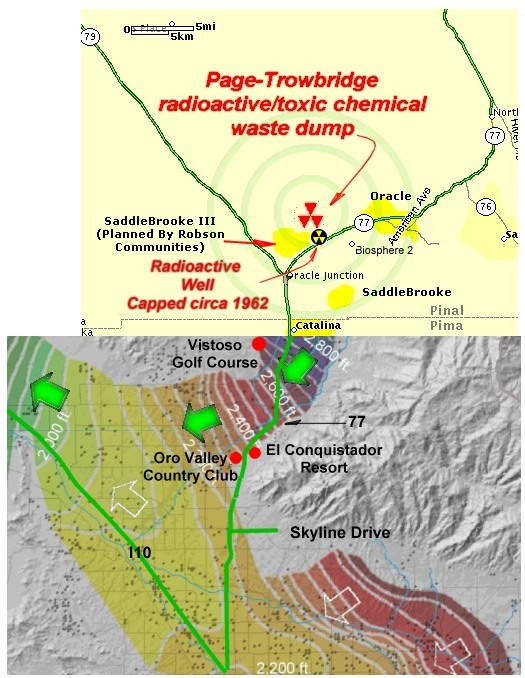
Annotation has been added to provide the reader with familiar landmarks. The arrows indicating the flow of the aquifer from the Page-Trowbridge radioactive/toxic waste landfill have been shaded green for clarity. The black dots in the vicinity of the green arrows represent wells that will be poisoned should the should the radioactive/toxic waste interred at Page-Trowbridge infiltrate the aquifer.
|
Use
The 'Back' Button On Your Browser
To
Return To Previous Page
News
& Information
Introduction
![]()
![]() email:mekazda@mindspring.com
email:mekazda@mindspring.com