|
April 5, 2001 |
 |
 |
 |
|
 |
 |
 |
photographs
by Al Nichols |
 |
 |
 |
|
 |
 |
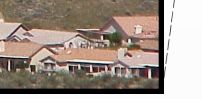 |
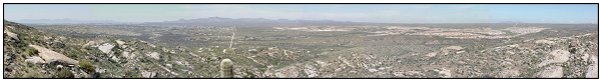
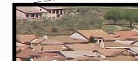
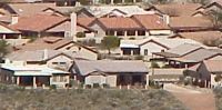
The panorama
above shows the borderline between Pima County and Pinal County.
The borderline is marked by County Line Road, which is clearly visible
in the image. County Line Road runs east/west.
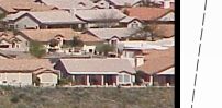
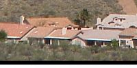
The Tortolita Mountains are on the borderline and clearly visible. The swath of green just north of County Line Road serves as a wildlife corridor between the mountain ranges (since it is the only corridor remaining between the Tortolita's and the Catalina's ). SaddleBrooke, advertised as "located in Metropolitan Tucson, Arizona," can be seen meandering over the desert, to the north of County Line Road.
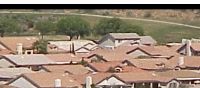
The community of SaddleBrooke is totally dependent on groundwater as are all communities in the region. However, unlike other communities in the region, SaddleBrooke consumes enormous amounts of groundwater to irrigate golf-courses.
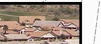
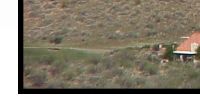
If you look closely at the panorama, you can see the faint image of Black Mountain on the right side of the image. The South Village of Willow Springs is proposed to be built in the foothills of Black Mountain. Between the retirement community of SaddleBrooke and the proposed retirement community of Willow Springs, another retirement community, called SaddleBrooke Ranch is also proposed. SaddleBrooke Ranch is supposed to have 3 golf courses all fed with water that is drawn from an aquifer that lies beneath a radioactive/toxic waste dump. These golf courses will consume up to 3,000,000 gallons of water per day. The retirement community of Willow Springs will also have a golf-course, so if these communities are actually built, several million gallons a day will be pumped from the aquifer for recreational purposes. Moreover, the water used to feed the golf-courses is totally consumed, so none of the water returns to the aquifer.
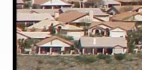
According to maps from the Arizona Department of Water Resources, SaddleBrooke is on the southeastern margin of the regional aquifer and the foothills of the Black Mountains are on the northern margin of the regional aquifer. If one believes that an aquifer is an "underground lake" one could come to the conclusion that regional aquifer has plenty of water, as it stretches from the existing SaddleBrooke retirement community to the foothills of Black Mountain. This would naturally lead
to the conclusion that the area can actually sustain more communities and
more golf courses.
The estimate is that 90 to 95% of the material in the regional aquifer is sand and gravel with only 5 to 10% being water. If you are interested in seeing what this means, try the following experiment:
This is a desert. There is very little water here If there is magic on this planet,
it is in water
Loren Eiseley |